 Catalogo de metadatos del IGME
Shape file
Type of resources
Available actions
Topics
Provided by
Years
Formats
Representation types
Update frequencies
status
Scale
-
Cartography of ferromanganese crusts deposits in which the mineralogical characterization, metallogenetic data and location are described, among other elements.
-
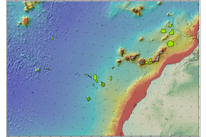
Outer limit of the Continental Shelf of Spain to the West of the Canary Islands.
-
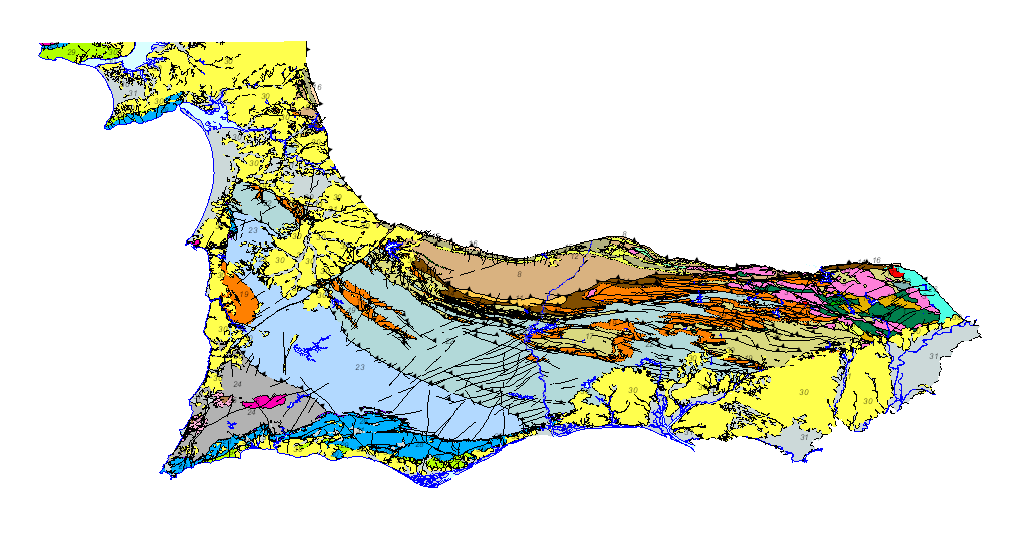
Geological map of the South Portuguese Zone, at a scale of 1/400,000, in which the geological legend on both sides of the border has been harmonized, with unified criteria between Spain and Portugal. This cartography is a product resulting from the GEO_FPI project: GEO_FPI: cross-border observatory for the geo-economic evaluation of the Iberian Pyrite Belt, financed by the European Regional Development Fund (ERDF) within the program INTERREG V-A Spain– Portugal (POCTEP) 2014-2020. The main beneficiary of the project is the Geological Survey of Spain (IGME). Additionally, the General Directorate of Industry, Energy and Mines of the Ministry of Employment, Enterprise and Commerce of the Andalusian Government (JA) and the Portuguese National Laboratory for Energy and Geology (LNEG) and the Municipal Chamber of Aljustrel (CMA) are partners of the project.
-
Geological map of the South Portuguese Zone on a scale of 1/200,000, in which the geological legend on both sides of the border has been harmonised with unified criteria between Spain and Portugal. This cartography is a product of the GEO_FPI project: Cross-border Observatory for the geo-economic exploitation of the Iberian Pyrite Belt, co-financed by ERDF funds through the INTERREG POCTEP 2014-2020 territorial cooperation programme. The main beneficiary of the project is the Geological Survey of Spain (IGME). The partnership for this project includes the Directorate-General for Industry, Energy and Mines of the Ministry of Finance, Industry and Energy of the Andalusian Regional Government (DGIEM), the National Laboratory of Energy and Geology, I.P. (LNEG) and the Municipal Chamber of Aljustrel (CMA).
-
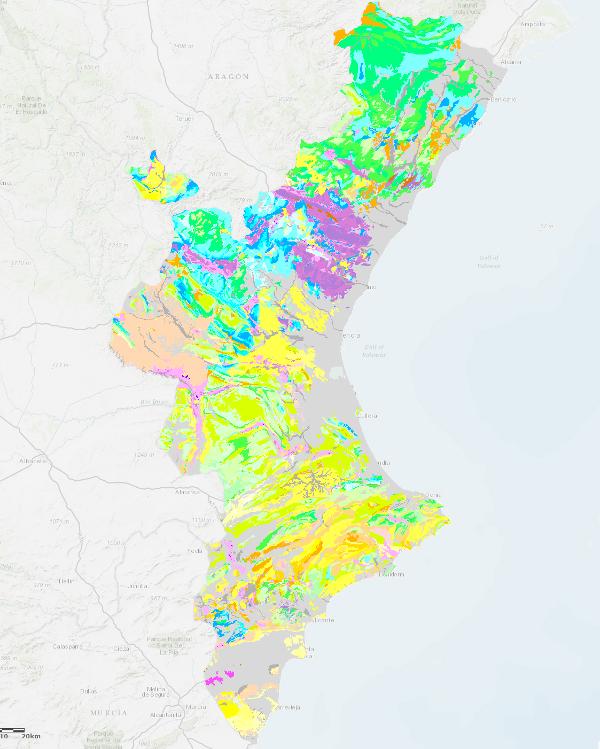
Map with the chronolithostratigraphic units of the Valencian Community accompanied by faults and folding structures. It is a unified geological synthesis based on IGME maps of this territory at 1:200.000 and 1:50.000 scale.